
By: Mia Ambroiggio ‘26 MEM
Jacob Peters, a third-year doctoral candidate at The Forest School at the Yale School of the Environment, is researching the ecological impacts of lianas (woody vines) in North American forests. Co-advised by Professor Mark Ashton and Professor Xuhui Lee, his dissertation examines native and invasive liana species — such as grapevines, kudzu, and bittersweet — and their effects on forest systems.
With a background in biology, Peters developed a strong interest in data analysis and mapping during his master’s degree. At Yale, he has expanded his research to incorporate remote sensing technology and drones. “I’m now not just making maps, but also making the things I need to make maps,” says Peters.
While Peters has always been interested in non-timber forest products, he first got interested in vines through a pilot study he conducted on the impact of lianas on tree growth in West Virginia. The project utilized drone imagery for a more accurate estimate of the shade the vine is providing to the tree. “These forests are really thick and really dense. When you’re standing on the forest floor it can be really difficult to look up and guess how much of a particular tree is covered by vines. So we thought, what if we could get above the canopy?” says Peters. During the pilot, Peters used a multispectral camera, which captures colors the human eye cannot perceive (like near infrared), and LiDAR. LiDAR, or light detection and ranging, measures how long it takes for a pulse of light to bounce back to the sensor it came from. Through utilizing LiDAR, Peters can determine tree characteristics — such as tree height to the nearest 10 centimeters, broken branches, and tree health — as well as the topography of the area.
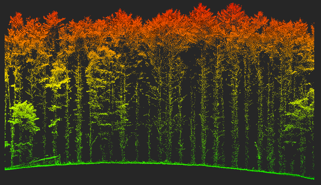
Transect taken from a LiDAR point cloud (colorized by altitude) from a “Drone Zone” pine stand. Photo: Jacob Peters
Peters continues this research at Yale, where he studies lianas across four sites: two on the eastern shore of the Chesapeake Bay in Maryland and two in West Virginia. By combining traditional field methods with remote sensing, Peters is studying how lianas influence tree growth and carbon storage across forests with distinct land-use histories. The Maryland sites neighbor agricultural land, while the West Virginia sites have undergone repeated high grading.
His dissertation aims to synthesize these data sources into a comprehensive study of liana management strategies. He is evaluating different management approaches – removing lianas entirely, leaving them untouched, or managing them selectively along roads and forest edges – to estimate their impact on tree growth and carbon storage. His findings, which consider variance among species and forest type, will provide place-based, scalable insights into liana management.
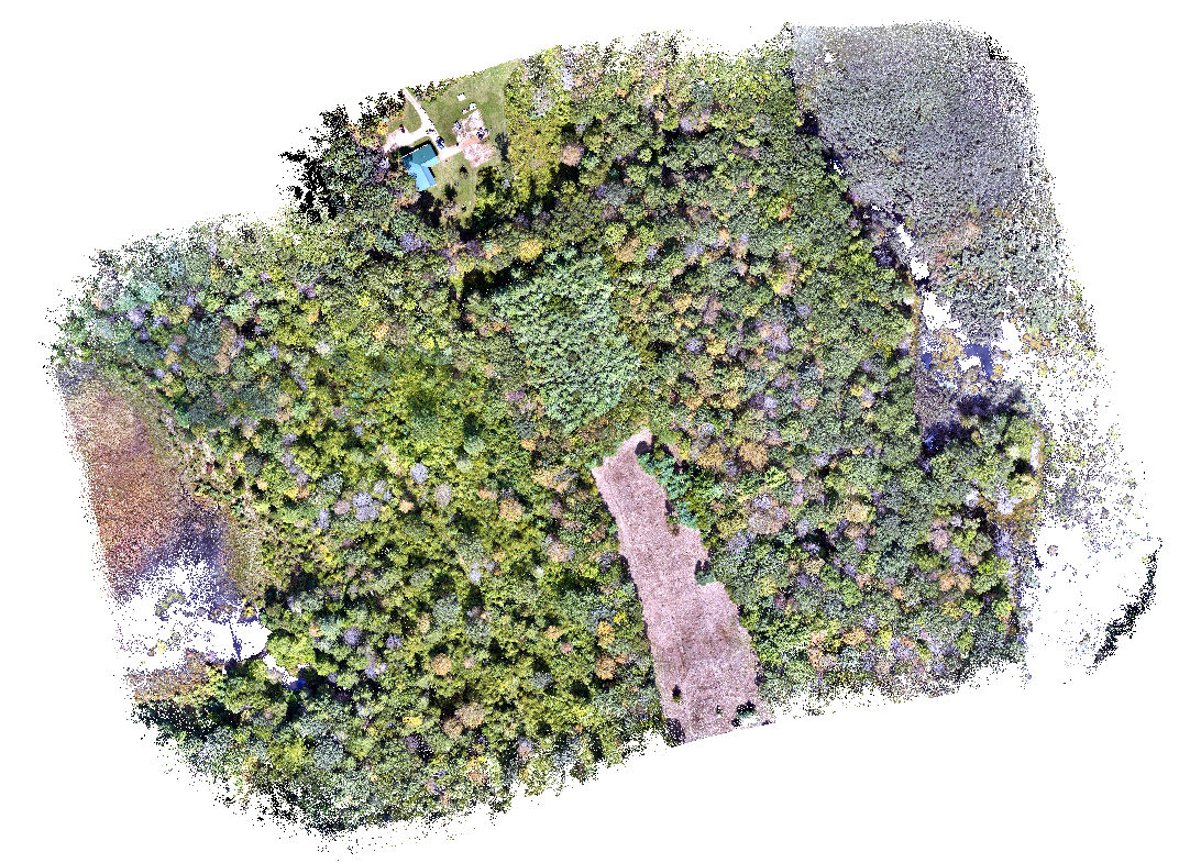
LiDAR imagery captures a mosaic of surface types and forest stands across the “Drone Zone” at Yale-Myers Forest camp. Photo: Jacob Peters
Peters is also exploring a broader question: what can remote sensing accomplish that traditional field methods cannot, and vice versa? While LiDAR excels in measuring tree height and uniform stands, such as pine plantations, it struggles with complex hardwood forests. “Field measurements are the truth, while remote sensing is a proxy of that truth,” says Peters. While LiDAR offers quantitative precision, it lacks tried and true field methods that allow foresters to gain a deep understanding of the understory. He emphasizes that effective forest management requires both approaches: remote sensing for broad-scale assessments and fieldwork for on-the-ground understanding. “In the case of considerate management of forests, there’s nuance, and good practitioners will recognize that it is still good to go out in the forest and measure trees, set up plots, and monitor the spaces you’re studying.”
Peters’ research has led to other benefits to The Forest School at large, such as the “Drone Zone” he set up at Yale-Myers Forest for students and researchers to troubleshoot drone technology. This designated area allows students and researchers to test drones and LiDAR and build a growing dataset of the forest.
Jacob Peters’ research is supported and funded by the Yale Center for Natural Carbon Capture and The Forest School’s Childs Research Grant.
 walks through Yale-Myers Forest with classmates on an agroforestry class field trip. Photo: Camilla Ledezma")


